NETWORK REALITIES
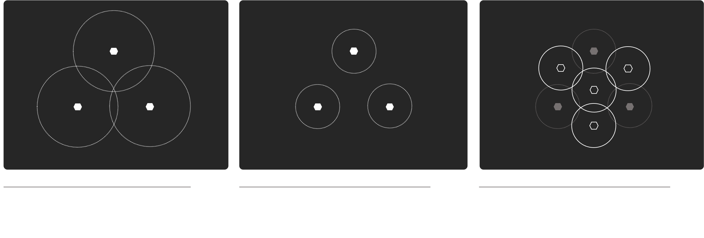
When demand is placed on a terrestrial network, the coverage area of each access site is reduced – resulting in coverage gaps.
As such, more sites are required – multiplying capital and operating expense requirements. However, barriers often exist to new site deployments (e.g., environment, terrain, security, tower mandates, grid access/reliability, market viability).
Next generation networks only magnify these problems.
A solution is required.
SATELLITES |
A DISTANT CONNECTION
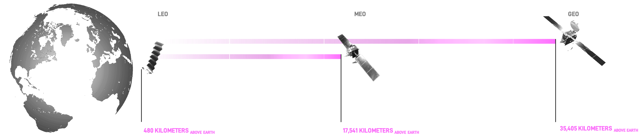
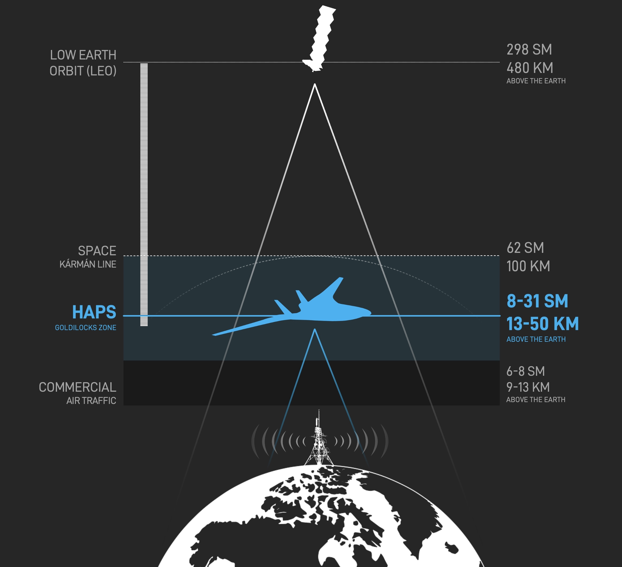
The closest satellites to Earth orbit at an altitude of ~1,573,440 feet (298 miles / 480 kilometers) above Mean Sea Level (MSL).
Although, orbital solutions can augment terrestrial networks in beneficial ways, their distance makes connectivity to unmodified handsets
(e.g., cell phones) difficult without user equipment (e.g., satellite dishes).
Other issues include –
- Atmospheric Drag: LEO satellites experience significant drag from the residual atmosphere, compelling orbital decay and atomic oxygen erosion – lowering operational lifetimes and increasing re-capitalization costs.
- Doppler Effects: LEO satellites orbit Earth roughly every 90 minutes, creating substantial frequency shifts that complicate signal synchronization.
- Latency: Typical LEO round-trip latency for Internet Protocol (IP) traffic is ~20-60ms (vs. ~1-10ms for a 5G tower signal).
- Congestion: Dense orbital populations creates a complex administrative atmosphere, higher collision risks, and potentially Kessler syndrome.
To meet the 6G vision of an AI/ML-native, decentralized lattice, a Non-Terrestrial Network (NTN) architecture is proposed by 3GPP – comprising ground, space, and air components.
HAPS |
AN ENDURING RESOLUTION
Impractically tall antenna masts or impossibly low satellites.
International Telecommunications Union (ITU) definitions:
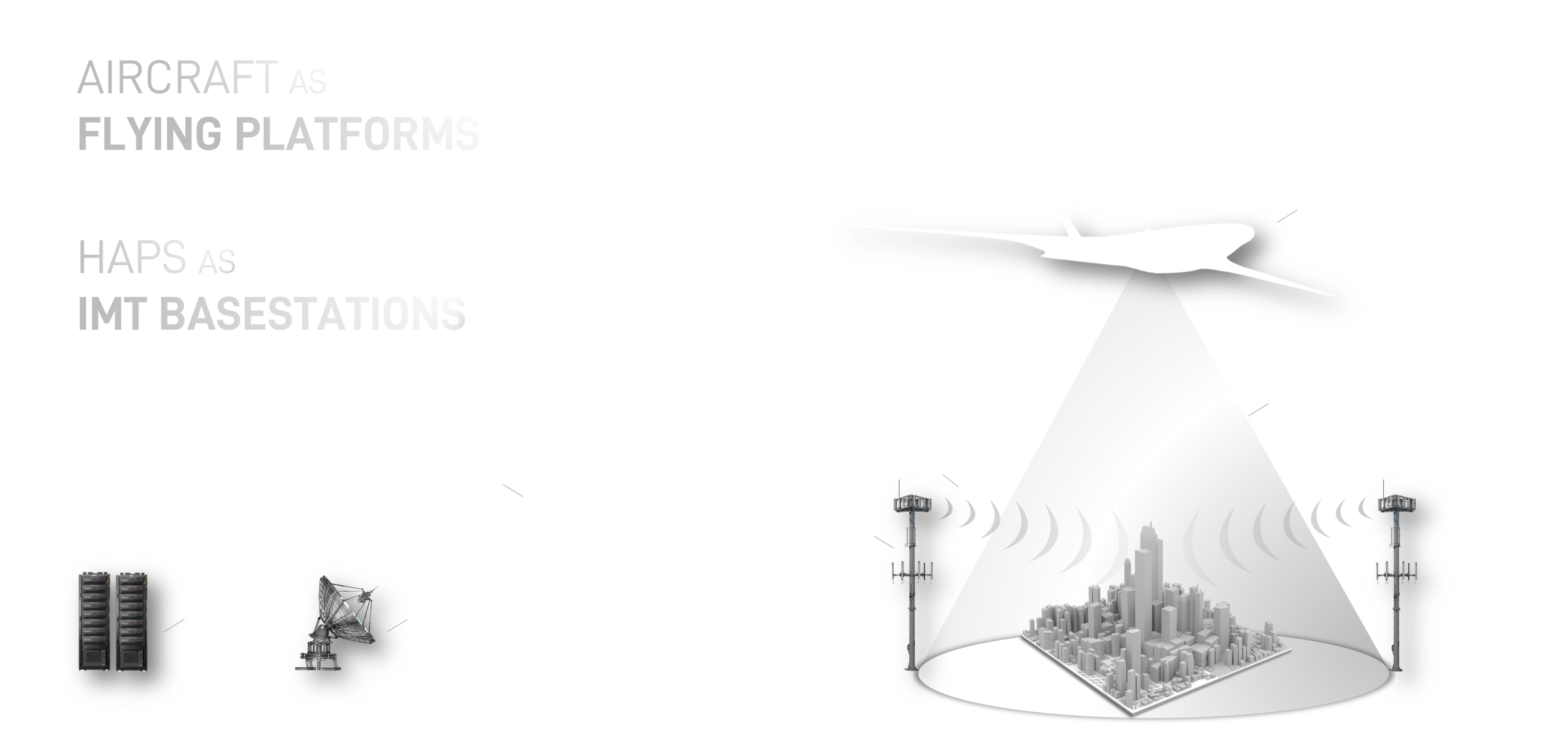
- HAPS: A station [aircraft] located on an object at an altitude of 20 to 50 km (65-164K’) and at a specified, nominal, fixed point relative to the Earth (ITU-T Y.3207 Definition; 04/2024)
- HIBS: High-altitude platform stations as IMT base stations (HIBS) would be used as part of terrestrial IMT networks, and may use the same frequency bands as ground-based IMT base stations (WRC-19; Resolution 247)
Understanding ITU and 3rd Generation Partnership Project (3GPP) on HAPS/HIBS as a telecom layer:
-
- The ITU notes that HAPS technology “offer[s] a new platform for providing mobile broadband access … using the same frequencies and user devices as IMT mobile networks,” and that key regulatory discussions at WRC-23 focused on enabling HAPS/HIBS to amplify terrestrial mobile service coverage and bridge digital divides in remote areas.
-
- Meanwhile, 3GPP’s 5/6G Non-Terrestrial Networks (NTN) framework explicitly includes HAPS alongside satellites – situating HAPS as part of a broader NTN segment whose purpose is to complement terrestrial cellular networks to extend coverage, continuity, and service availability.
- This multi-tiered approach aims to “bridge terrestrial and non-terrestrial infrastructures” by leveraging HAPS for scalable coverage enhancement and resilience in 6G, creating a hierarchical network capable of adjusting coverage, bandwidth, and reliability across diverse environments.
CONNECT EARTH
Seize this moment to relieve tower rent, access international spectrum reserved for High-Altitude Platforms, and step boldly into a telecommunications epoch.
VALUE
SIGNALS EPOCH
– Tower-like latency
– Inherent synchronization
– High spectral utilization efficiency
– Lower same/adjacent cell interference
– Faster/softer handover between cells
– Better look-angle (higher link qualit)
– Improved Path loss (Ricean)
– Improved Forward Link Power Control
CONTINUITY
Signals For Connected Continuity
– Disaster-immune access layer
– Platform redundancy
– Limited ground segment dependency
– Rapid redeployment
– Backup power and links
– Stable, localized platforms
– Centralized control and automation
SECURITY
Defense-In-Depth for Zero-Trust Environments
– Zero-Day threat posturing
– Active Cyber Protection
– Centralized patching
– Isolated power/backhaul
– Advanced encryption/keying
PERFORMANCE
Deterministic Connectivity At Operational Scale
– Upgrade network between flight cycles
– Centralized maintenance
– Software-defined upgrades
– Predictive maintenance
– Power cycling without field dispatch
OBSERVE EARTH
High-Altitude Platforms are sky towers.
Always available and technologically agnostic –
offering new insights and uncommon resolution throughout the electromagnetic spectrum.
Plan, execute, learn, and respond with SKYRAY.
SPATIAL RESOLUTION
HEADING
– Low-altitude high fidelity
– Flexible viewing geometries
– Fine-grain feature detection
– Minimal atmospheric distortion
– Targeted area focus
– Continuous regional coverage
– High signal-to-noise ratios
Temporal Persistence
Temporal Persistence
– Enduring availability
– Continuous revisit, zero gaps
– Real-time change detection
– Persistent stare capability
– Event-driven retasking
– No orbital constraints
– Long-duration monitoring
– Always-on sensing layer
Sensor Diversity
HEADING
– True payload agnosticism
– RF sensing and mapping
– Atmospheric composition monitoring
– Environmental and climate sensors
– In-flight logical customization
– Upgrade between flight cycles
– Multi-modal data fusion
– Custom mission sensor mixes
Operational Value
Signals Powering Intelligent Operations
– Rapid deployment
– On-demand sensing
– Lower cost than satellites
– Sovereign-controlled observation
– Resilient during disasters
– Non-intrusive monitoring
– High throughput datalinks
– Edge processing onboard
– Regulatory-friendly operations
Reclaim your baselines.
Unlock a new global airborne layer of open wireless communication and observation.